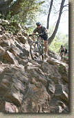
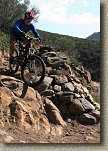
Tour De Noble
Looking for a big ride? You want to get the full Noble Canyon experience? You think shuttling is for chumps. Well then shoppers, for the mere price of about 30 miles and 3,000 feet of climbing, you can proudly add the "Tour de Noble" to your "Been There Done That" list. This ride is a combination of several rides here on the site: Noble Canyon, The Laguna Mountain Recreation Area and the Cuyamaca to Noble route. Noble Canyon on it's own is considered a SoCal Classic and doing this route gets you the deluxe package of three distinct ecosystems including desert scrub, oak forests and alpine meadows. Done at certain times of the year you will might have to wipe some snow off of your shorts.
Directions: From San Diego, take I-8 east to the off ramp for Pine Valley. Exit the highway and turn left. Travel north for .3 miles to Old Highway 80. Turn left onto Old Highway 80 and travel about 1.2 miles to Pine Creek Road. Turn sharply right onto Pine Creek Road and travel 1.6 miles to the trailhead parking on the right. A National Forest Adventure Pass is required.
|
|
 Map: To the left is a map of route
and below is the elevation profile. Map: To the left is a map of route
and below is the elevation profile.
|
Hazards: Treacherously technical trail with steep drop offs just off the trail. This is not a place to try to bring a beginner. This place can get really hot in the summertime and the lower portions are very exposed.
Ride Notes: (While this is a big ride, you can even "Super-Size" even more, starting right with the start)
The Extra Credit Start: If you are into the challenge of some technical climbing I recommend taking the trail up. You will have a 1 mile climb up to a saddle where you will some very technical spots to navigate. After this main section of climbing you get to enjoy a fun downhill section. At around 2.5 miles, the Noble Canyon trail makes a very distinct switchback turn. There is also a trail that shoots off the the west that will quickly take you to Pine Creek Road. Take the cutover trail and turn right when you hit Pine Creek Road. From there it is a 2.2 mile climb up 950 feet to the junction of Pine Creek Road and Laguna Meadow Road.
The Normal Start: From the lower trailhead go back to the road you came in on, hang a right and start up Pine Creek Road. After a little bit of mild rolling, the climb turns into a meat grinder with some really nasty pitches. At 3.6 miles the pavement will make a sharp right hand turn at a large Oak Tree. From here you will continue straight and downhill onto Pine Creek Road. This dirt road is a nice break from the climbing. At 5.1 miles you will come to the junction with the Indian Creek trail on your right. (The Deer Creek trail will be coming in on your left at the same spot, but that is another ride.)
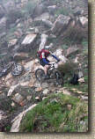
Turning right onto the Indian Creek trail starts a downright mean two-mile climb. The grade is only about 14% but the trail has many technical and loose sections that make you work even harder.
The foggy pictures below are from a socked in climb on the Indian Creek trail on April 16th, 2007. The clear one are from a ride on May 19th.
At 7.0 miles we reached Champagne Pass and the end of most of the grunt work climbing for a while. At Champagne Pass there is a four-way intersection. The trail to the left goes up to a better vantage point, Straight ahead the Indian Creek trail continues on and to your left is the start of the Pine Mountain trail.

At Champagne Pass looking west
We took the left onto the Pine Mountain trail where we did a little bit more climbing before we enjoyed a nice and slightly downhill cruise for the next two miles. At 9.2 miles the Pine Mountain trail comes out onto the paved Sunrise Highway.
 From here you will hang a right and ride along the highway (two lane mountain
road) for just under two miles to the Pine Pines parking lot and the upper
trailhead of Noble Canyon. (For a quite viewpoint diversion: At the
trailhead, pick up a trail on the north side of the road and take a quick
200 yard hike over to the Pacific Crest Trail where you will
most likely find a stunning view of the Anza-Borrego Desert below.)
Note: There is normally water at the Noble trailhead. If for some reason
it is turned off you can got to the Big Laguna Campground, further along on this
route.
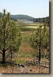
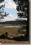 From
the upper trailhead parking area you will proceed south on the Noble Canyon
trail for about 100 yards and hang a left onto the Big Laguna Trail (normally
referred to as the BLT). From there you will have about a mile of a very
gradual climb up to the Big Laguna Meadow. Just before you reach the
meadow the climbing will stop. It is in this area that you will see
a trail off to your right. Make note of it but you are not taking
it. Continue on as you cruise down to the meadow that you should see by
now. There will be a split in the trail at the edge of the meadow.
Either direction is good, but for this description you will take the right fork
in the trail and go around the meadow counter-clockwise.
Shortly after the trail around the meadow bends almost 90 degrees to the left to stay with the meadow you will see another trail splitting off to the right. This is the Sunset trail which is off limits to bikes so bear to the left and stay on the Big Laguna trail. The trail will continue following along the west side of the meadow and eventually Big Laguna Lake as well.

