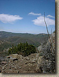
Champagne Pass in Laguna Mountains looking west at Cuyamaca Peak
|
This ride will fit into most anyone's idea of an epic ride. It is long,
with some rough terrain, but rewards you will stunning views and technical
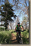
single track. This ride takes you through grassy meadows, pine
forests, rocky exposed cliff sides, and chaparral on mostly single track.
This ride is grueling over the long haul but you feel like a bad ass when
you get done with it. The ride is a combination of quite a few trails
strung together. They are: East Mesa Fire Road, Deer Park trail, Indian
Creek Trail, Pine Mountain trail, and the upper portion of Noble Canyon. This route is also part of the truly epic Stagecoach 400 route/endurace race that encompasses 385 miles of some of SoCal's mountains, deserts and coastal area trails. |

The e Deer Park trail that meanders
through some beautiful meadows and hillsides of the Cuyamaca Mountains. |
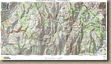  Here
is a PDF map of the ride sized to be printed on legal sized paper. Here
is a PDF map of the ride sized to be printed on legal sized paper.
 Elevation
Profile. Elevation
Profile.
GPS Files: TOPO!, GDB, GPX, KML |
| Hazards: This place is hot in the summer. Technical
single track with some very nasty cliffs/drop offs just off the trail in
spots. While I love solo rides, but I don't think it
would be smart to do this as a solo because if you get hurt you will be out in
the middle of no where and this is not a main stream trail. This place could get really hot in the summertime. |
Directions:
|
From LA - North San Diego County: From I-5 or I-15 take the 78 East
into Escondido. Follow the signs closely as the 78 makes a few turns
through town. Once through Escondido continue east on the 78 into
Ramona. In Ramona the 78 will turn left. Continue along the 78
east into Julian. In the Julian the 78 will turn right. Continue
east on the 78 for about 3/4ths of mile and then take HWY 79 south.
Take the 79 south past Sunrise Hwy, Lake Cuyamaca, the Park Headquarters on
the left, and park in the the Horse trailer parking area on the left.
|
|
From San Diego area: Take I-8 east past Alpine. Take HWY 79
north. Park in the only large parking lot on the right hand
side. You will probably see a few horse trailers there. |
|
Ride Report:
  This
epic ride was done on my 34th birthday. The ride started in Cuyamaca State Park
about an hour east of San Diego. Normally I like to ride early or late as I am
not a big fan of the heat. This ride however started at 10AM because one of the
guys must have planned on having the brown bottle flu after the 4th. So I meet
Michael Paul, Sorni, and Dave at the large horse staging area on the east side
HWY 79 inCuyamaca
State Park. Guess who is a no-show. Mr. "I need to start at 10AM". This
epic ride was done on my 34th birthday. The ride started in Cuyamaca State Park
about an hour east of San Diego. Normally I like to ride early or late as I am
not a big fan of the heat. This ride however started at 10AM because one of the
guys must have planned on having the brown bottle flu after the 4th. So I meet
Michael Paul, Sorni, and Dave at the large horse staging area on the east side
HWY 79 inCuyamaca
State Park. Guess who is a no-show. Mr. "I need to start at 10AM".
|
  So
we started out by heading south on the East Side Trail and then hooked up with
the East Mesa fire road. Shortly into this climb nature started
calling Choices, choices, I want to give this climb a good attack, but I
had pressing matters. I decided to do the climb, then take care of things.
Well I was properly motivated and I kicked ass on the climb and business was
taken care of by the time the restof
the guys got to the top. I keep alittle
TP in my pack for just such occasions. Michael's pack is a little on the small
side so he had asked me to carry his sandwich for him. Lucky for him I had
enough TP otherwise he would have gone hungry on this ride :-). So
we started out by heading south on the East Side Trail and then hooked up with
the East Mesa fire road. Shortly into this climb nature started
calling Choices, choices, I want to give this climb a good attack, but I
had pressing matters. I decided to do the climb, then take care of things.
Well I was properly motivated and I kicked ass on the climb and business was
taken care of by the time the restof
the guys got to the top. I keep alittle
TP in my pack for just such occasions. Michael's pack is a little on the small
side so he had asked me to carry his sandwich for him. Lucky for him I had
enough TP otherwise he would have gone hungry on this ride :-).
|
  From this
point we roll along the fire road a little further until at around mile 5
Granite Spring trail peels off to the left by an information kiosk. From this
point we are on single track that goes roughly north across a meadow. At around
7.5 miles we get a break from climbing as well turn right onto Deer Parktrail.
This is fun single trail that has you cutting around pines at the top and
eventually switching over to scrub brush towards the bottom. At around 9 miles
we get to the border of Cuyamaca State Park and the Cleveland Nation Forest and
go through a horse/cattle gate. Suddenly the trial changes its name to Indian
Creek Trail. (Talk about bureaucracy). The next two miles are a downright mean
climb. From this
point we roll along the fire road a little further until at around mile 5
Granite Spring trail peels off to the left by an information kiosk. From this
point we are on single track that goes roughly north across a meadow. At around
7.5 miles we get a break from climbing as well turn right onto Deer Parktrail.
This is fun single trail that has you cutting around pines at the top and
eventually switching over to scrub brush towards the bottom. At around 9 miles
we get to the border of Cuyamaca State Park and the Cleveland Nation Forest and
go through a horse/cattle gate. Suddenly the trial changes its name to Indian
Creek Trail. (Talk about bureaucracy). The next two miles are a downright mean
climb.
|
  The grade is only
about 14% but the trail has many technical sections that make you work even
harder and the temperature has climbed to around 90 degrees. We all struggleto
varyingdegrees up the to top of this first climb. We are around 11 miles now
and we are also at the junction of Pine Mountain Trail. This is where we all
realized that we had bit off a little more that we had originally planned on.
After debating whither to turn around here or continue on, we decided to
continue on because we did not have enough water to get back to
the cars, so we were committed to getting to the top of the Noble Canyon trail.
Take Pine Mountain Trail or Indian Creek? We decided to enjoy the Indian Creekdownhill. The grade is only
about 14% but the trail has many technical sections that make you work even
harder and the temperature has climbed to around 90 degrees. We all struggleto
varyingdegrees up the to top of this first climb. We are around 11 miles now
and we are also at the junction of Pine Mountain Trail. This is where we all
realized that we had bit off a little more that we had originally planned on.
After debating whither to turn around here or continue on, we decided to
continue on because we did not have enough water to get back to
the cars, so we were committed to getting to the top of the Noble Canyon trail.
Take Pine Mountain Trail or Indian Creek? We decided to enjoy the Indian Creekdownhill.
|
|
  We had a lot fun on themoderately technical downhill run that turned
uphill all to soon. After about half a mile of moderate climbing we came to the
junction of the Noble Canyon Trail. We hung a left and continued our death march
uphill. After two more miles of mostly climbing we reached the upper trailhead
of Noble Canyon at Sunrise Highway. After a rather lengthy rest and bladder
refill we hopped on the road and went east for two miles. We then hung a left
into the Pioneer Mail Picnic Area and hooked up with the Pine Mountain Trail. We
immediately were back into the mostly technical uphill single-track
scene. The views were quite stunning as we climbed and climbed. We peaked out at
the 20-mile mark and shortly there after we rejoined the Indian Creek Trail.
This completed our loop portion fo the this lollipop shaped ride. The next 2
miles were pretty technical with a couple of gnarly sections. The difficulty of
this section was compounded by the fact that we were all pretty tired and beat
up by the sun. We all made it down without exfoliating any DNA. We had a lot fun on themoderately technical downhill run that turned
uphill all to soon. After about half a mile of moderate climbing we came to the
junction of the Noble Canyon Trail. We hung a left and continued our death march
uphill. After two more miles of mostly climbing we reached the upper trailhead
of Noble Canyon at Sunrise Highway. After a rather lengthy rest and bladder
refill we hopped on the road and went east for two miles. We then hung a left
into the Pioneer Mail Picnic Area and hooked up with the Pine Mountain Trail. We
immediately were back into the mostly technical uphill single-track
scene. The views were quite stunning as we climbed and climbed. We peaked out at
the 20-mile mark and shortly there after we rejoined the Indian Creek Trail.
This completed our loop portion fo the this lollipop shaped ride. The next 2
miles were pretty technical with a couple of gnarly sections. The difficulty of
this section was compounded by the fact that we were all pretty tired and beat
up by the sun. We all made it down without exfoliating any DNA.
|
  From this point
we reentered Cuyamaca State Park and that fun downhill on the way out was now
kicking my asson theway back. I had not fed myself properly through the ride
and I was paying the price now. I was having a tough time with the technical
stuff. After finally calling for an "undue" rest stop, I recovered and
the rest of the ride was less painful. Our group pace was by now downright slow,
but no one was jockeying for the lead and no was complaining. As we reached the
top of Deer Park Trail and into the open meadow again the computer ticked over
24 miles. Normally we would have been bombing the single-track but everyone was
pretty content just to roll right along. From this point
we reentered Cuyamaca State Park and that fun downhill on the way out was now
kicking my asson theway back. I had not fed myself properly through the ride
and I was paying the price now. I was having a tough time with the technical
stuff. After finally calling for an "undue" rest stop, I recovered and
the rest of the ride was less painful. Our group pace was by now downright slow,
but no one was jockeying for the lead and no was complaining. As we reached the
top of Deer Park Trail and into the open meadow again the computer ticked over
24 miles. Normally we would have been bombing the single-track but everyone was
pretty content just to roll right along.
|
  Once we joined back up with East Mesa
fire road we were all looking forward to a long downhill. What we got was a
gradual 1.5 mile climb that seemed to go on forever and was pretty rough on our
baked legs. By the time we got to downhill portion of the fire road we just
wanted to get done with the ride. The fire road was not as much of a rest as we
thought because with the current fatigue level you had to be extra careful as
the road throws a little loose sand and ruts in at all the worst places. Once at
the bottom we were back on the East Side trail. The last half of which was
painful for fully cooked legs. This was a hell of birthday ride which had 3
hours and 42 minutes of in the saddle time over 31 miles with 4,570 feet of
mostly rough climbing. As I was driving home (And late for my own party) with
most of my muscles hurting I was thinking, 31 miles on my 34th birthday. Hmmm if
I tweak the start point of the route a little I could squeak out 4 more miles
and I could do a 35-miler on my 35th birthday next year. Sounds like a plan. Once we joined back up with East Mesa
fire road we were all looking forward to a long downhill. What we got was a
gradual 1.5 mile climb that seemed to go on forever and was pretty rough on our
baked legs. By the time we got to downhill portion of the fire road we just
wanted to get done with the ride. The fire road was not as much of a rest as we
thought because with the current fatigue level you had to be extra careful as
the road throws a little loose sand and ruts in at all the worst places. Once at
the bottom we were back on the East Side trail. The last half of which was
painful for fully cooked legs. This was a hell of birthday ride which had 3
hours and 42 minutes of in the saddle time over 31 miles with 4,570 feet of
mostly rough climbing. As I was driving home (And late for my own party) with
most of my muscles hurting I was thinking, 31 miles on my 34th birthday. Hmmm if
I tweak the start point of the route a little I could squeak out 4 more miles
and I could do a 35-miler on my 35th birthday next year. Sounds like a plan. |
|
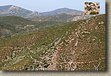
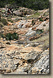
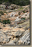
The 2003 the San Diego wildfires devastated some our best
trails. The entire trail system for this loop was burnt. Here are some
photos of the Indian Creek area. You can check out the Noble
Canyon page for some additional fire damage photos.
The two pictures below where shot by Mark Costantino on November 2nd,
2003
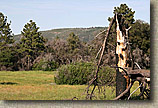
The Noble Canyon/Indian Creek intersection

East side of the Indian Creek trail from the Noble Canyon
Trail

Recovery
Indian Creek Trail reopened in the summer of 2004. Make sure to take a look at the
2007 pictures below. |
|
I was going to go through my original ride report above and edit
it to better suit my current style of writing. However when reading
through it I liked that it could almost pass for a blog entry so I decided to leave it intact and add the updated information
here. The major changes to note here are that I would now do the Pine
Mountain, Noble and Indian Creek loop portion in the opposite direction. At
the top of Champagne Pass, hang a left onto the Pine Mountain trail and
enjoy a mostly gradual downhill cruise to Sunrise Highway. Continue the rest of the
loop going in that direction. To really add to this loop, add a
diversion out to the Laguna Meadows via the Big Laguna Trail. |
 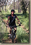    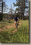  
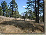
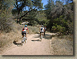
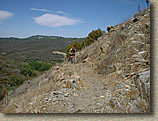
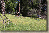
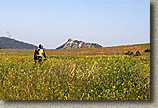
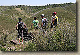
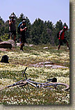
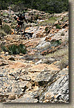
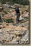
The crew working their way the East Mesa fire road. There were quite a few
new faces for me and I was glad to ride with all of them. |
  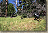   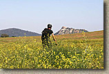 
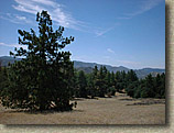
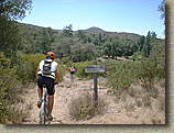
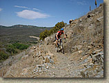
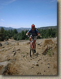
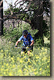
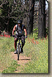
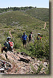
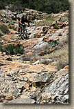
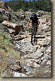
If you do not get a little jazzed about riding through stuff like this, you
should get a road bike and an indoor trainer. |
|
    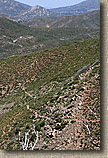  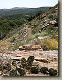
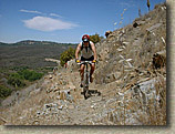
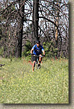
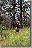
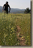
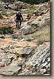
The loose and often technical climb up the Indian Creek trail can really sap
your energy. The group pretty much splintered from here with some opting
to turn around here and make the ride an out-and-back, while another group choose to go
down Indian Creek and make a smaller loop than originally planned.
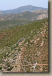
Three of us opted to take the Pine Mountain trail and get up into the Laguna
Mountains.
  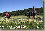  
Once at the top of Noble Canyon we took the diversion over to the Big Laguna
trail (BLT) to get a bit of a wild flower fix. If you are looking to add
this option check out the Laguna Recreation Area and "Tour De Noble" pages. Combined with
this page you should have enough maps and directions.
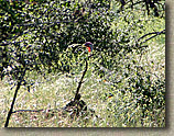
On the return trip Steve, stopped to play on the Indian Creek "Waterfall".
It is much harder than it looks and he is on a rigid bike.
 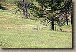 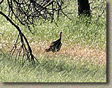  
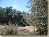
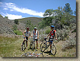
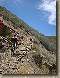
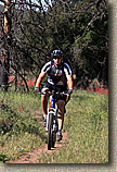
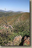
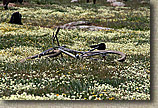
A few more views and critters from along our way back to the East Mesa trailhead and the
end of our 37 mile adventure for the day. |
|
 Here is an old school lipstick style helmet camera footage from my birthday ride described above, This was 31 miles with 4,500 feet of climbing with the high temp of
the ride being in the low 90s. Needless to say we were pretty whooped when
done. 20MB Here is an old school lipstick style helmet camera footage from my birthday ride described above, This was 31 miles with 4,500 feet of climbing with the high temp of
the ride being in the low 90s. Needless to say we were pretty whooped when
done. 20MB
|
|
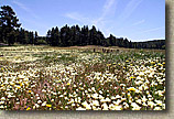
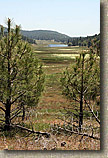
 We spent a day playing in the Cuyamaca and Laguna Mountains on
May 19th, 2007. Our 40 mile adventure, included the route described on this page as well as some additional parts of the Laguna Mountain Recreation Area (BLT). A portion of this route is also part of the "Tour De Noble". There were plenty of spring time flowers in bloom made this a beautiful day to be out on a mountain bike. While the flowers are not as explosive as in this video, much of the route in this video was quite colorful in the spring of 2015. This 8 minute and 29 second video is 114MB in size. We spent a day playing in the Cuyamaca and Laguna Mountains on
May 19th, 2007. Our 40 mile adventure, included the route described on this page as well as some additional parts of the Laguna Mountain Recreation Area (BLT). A portion of this route is also part of the "Tour De Noble". There were plenty of spring time flowers in bloom made this a beautiful day to be out on a mountain bike. While the flowers are not as explosive as in this video, much of the route in this video was quite colorful in the spring of 2015. This 8 minute and 29 second video is 114MB in size.
|


 Once we joined back up with East Mesa
fire road we were all looking forward to a long downhill. What we got was a
gradual 1.5 mile climb that seemed to go on forever and was pretty rough on our
baked legs. By the time we got to downhill portion of the fire road we just
wanted to get done with the ride. The fire road was not as much of a rest as we
thought because with the current fatigue level you had to be extra careful as
the road throws a little loose sand and ruts in at all the worst places. Once at
the bottom we were back on the East Side trail. The last half of which was
painful for fully cooked legs. This was a hell of birthday ride which had 3
hours and 42 minutes of in the saddle time over 31 miles with 4,570 feet of
mostly rough climbing. As I was driving home (And late for my own party) with
most of my muscles hurting I was thinking, 31 miles on my 34th birthday. Hmmm if
I tweak the start point of the route a little I could squeak out 4 more miles
and I could do a 35-miler on my 35th birthday next year. Sounds like a plan.
Once we joined back up with East Mesa
fire road we were all looking forward to a long downhill. What we got was a
gradual 1.5 mile climb that seemed to go on forever and was pretty rough on our
baked legs. By the time we got to downhill portion of the fire road we just
wanted to get done with the ride. The fire road was not as much of a rest as we
thought because with the current fatigue level you had to be extra careful as
the road throws a little loose sand and ruts in at all the worst places. Once at
the bottom we were back on the East Side trail. The last half of which was
painful for fully cooked legs. This was a hell of birthday ride which had 3
hours and 42 minutes of in the saddle time over 31 miles with 4,570 feet of
mostly rough climbing. As I was driving home (And late for my own party) with
most of my muscles hurting I was thinking, 31 miles on my 34th birthday. Hmmm if
I tweak the start point of the route a little I could squeak out 4 more miles
and I could do a 35-miler on my 35th birthday next year. Sounds like a plan.