Noble Canyon
Noble Canyon is considered to be one of the best trails around Southern California. It is technically difficult with narrow single track, gnarly rocks and tight switchbacks. This ride takes you through three distinct ecosystems. You start out in alpine meadows and oak trees that transitions into typical Southern California chaparral and finally into the arid desert climate near the Anza-Borrego desert. At some times of the year you can start the ride will plenty of snow on the trail and by the end of the ride be in 85 degree desert heat. This is normally considered an advanced ride. This ride will be fun for intermediate riders but you will most likely find yourself doing some walking over and down obstacles.
To
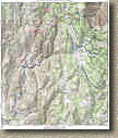
the left is a PDF map of the ride
 .
.
Here
is the elevation profile for the ride.
Electronic GPS Files: TOPO! GPX GDB KML
Directions: There are several ways to do Noble Canyon. You can certainly do to the shuttle thing and start at the upper trailhead on Sunrise Highway. You can start at the lower trailhead at the Pine Creek Picnic Area and have yourself a really a really good climb up Deer Creek Road and Laguna Meadows Road to get to the upper trailhead and then go down Noble, Or you can do the Laguna Noble ride I describe here. The map here and the description should be enough for you to do what ever variation you desire.
A National Forest Adventure Pass is required at the Upper Trailhead and the Lower Trailhead as well.
|
||
|
||
|
Hazards: Treacherously technical trail with steep drop offs just off the trail. This is not a place to try to bring a beginner. This place can get really hot in the summertime and the lower portions are very exposed.
Ride Report:
We normally do this ride as part of a Laguna Noble Combination ride that I describe below. For this ride we left a vehicle in the parking lot of the General Store in Pine Valley and then driving up Sunrise Highway into the Laguna Recreation Area and then do 12 mile or so XC ride trough forests and wide meadows that takes us to the upper trailhead of Noble Canyon. Then we head down Noble Canyon. About a mile before the we get to the "traditional" bottom of Noble Canyon we take a trail off to the left and make our way into Pine Valley and ultimately to the General Store. I don't think of this as a shuttle monkey route but a point-to-point shuttle route. This ride report picks up at the Upper Noble Canyon trailhead.
The upper Noble Canyon trailhead parking area. There is a water faucet
beside the trail just below the trail head. Make sure your water is topped
off before you head out down Noble Canyon.
A quick 200 yard hike from the upper trailhead over to the
Pacific Crest Trail
offers a stunning view of the Anza-Borrego Desert below.

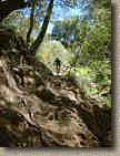 The
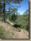
upper Portion of Noble Canyon offers some smooth rolling single track and a
short gradual climb before the descending starts. You will cross
Pine Creek Road a couple of times as you head down Noble Canyon. Also you
will pass the junction of Indian Creek Trail that will take you out to to
Cuyamacas. You can use this trail to do a truly epic
Cuyamaca to Noble Loop. After descending for some time along the fast
smooth stuff you will come to a horse gate. At this point you are probably
be thinking to yourself "What is the BIG deal? The is not technical at
all" Beyond this point the trail
changes dramatically. Just after the gate you will a have to navigate some tight
switchbacks and the terrain starts changing from forest to chaparral. Also
the trail starts get rockier and more technical. At the first dry
creek crossing is where you encounter the first really technical rocky
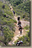
outcropping. (Upper left above you can see Collin working this
 section.)
After this section you have a long descent that is packed with drops and rocks that
requires good bike handling skills. Speed can be your friend
here. I did not take many pictures from through this section but you
can see most of it in the video. The terrain continues to
change the further down you go. Before too long you leave the chaparral
and find yourself in desert scrub. The trail is very narrow with the penalty
for failure being quite steep if you screw up. No macho pride here for me,
I had some additional protection on. On one section the trail was really
loose and everything sort of slide off the trail to the left and downhill.
Collin was a head of me and it tripped him up. I saw it happening and
tried to make a last second change of
  lines.
Well I did not pull it off and found myself sliding down the side of the
hill. Somehow I had managed to get my leg tangled up in my frame. I
also could not move much without sliding down the for Lord knows how far.
Lucky for me my Homeez were there to get me untangled and back up on the
trail. Somewhere further down the trail I managed to shake my
battery loose from the camcorder so the video did not capture some of the
other truly gnarly sections.
One such section is know as the the "Stairway to Hell". There is no "line" per se through this section. Just a bunch of rocks all over the place. Speed and good weight transfers are the name of the game here. My extra protection more that paid for itself (again) by the time I got through this section.
Strike One  Strike Two
  and
and
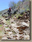
Finally on the third attempt I make it down
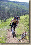
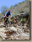 Michael and Collin show us how it done on a hard tail
After spending good bit of time in this section we continued along down the trail. There is an very obvious trail near the bottom peels off to the left as the main trail makes are right hand turn. There is a sign that annotates that the main trail is Noble Canyon and goes to Pine Creek Picnic Area. The trail to the left heads into Pine Valley and it was smooth with some short gradual climbs. It ultimately dumped onto a paved residential street. I don't remember the exact streets but if your are heading down hill it will all come out the main drag of this little hamlet where the General Store is one of the center pieces. This route is somewhere around 11-12 miles.
Special Thanks to Michael Paul for providing some of the pictures on this page
2004 Ride Information
I
did the the climb up from the bottom trailhead route for the first time recently
(January 17th, 2004). From the lower trailhead you can either go back to
the road you came in on and start up Pine Creek Road or you can ride up the
trail. If you are into the challenge of some technical climbing I
recommend taking the trail up. You will have a 1 mile climb up to a saddle
and there are some very technical spots to navigate. After this main
section of climbing you get to enjoy a fun downhill section. At around 2.5
miles, the Noble Canyon trail makes a very distinct switchback turn.
There
is also a trail that shoots off the the west that will quickly take you to Pine
Creek Road. We took this trail and then continued up Pine Creek
Road. From here it is a 2.2
mile
climb up 950 feet to the junction of Pine Creek Road and Laguna Meadow
Road. Here you could clearly see much of the burn area, particularly
the Indian Creek trail cutting across the hills to the north.
From we continued on 2.2 more miles up the paved Laguna Meadow Road.
It is not all an uphill grind like Pine Creek Road. You end up going up
roughly going up 800 feet and down 300 feet before you get to where the Noble
Canyon trail cross the road. From here you will hang a right and
enough the downhill technical goodness that Noble Canyon is renowned for.
You never know who you may run into on this trail. Here is two-time XC
NORBA Champ Jimena Florit
out "playing" with the guys. She totally schooled us all while
not even appearing to break a sweat.

The view from the lower portions of Noble looking back up towards the Laguna
Mountains on July 31st,2005.
Laguna to Noble Combination Ride
Read my Laguna Mountain Recreation Area review then you can use the map and profile below. Combining the buffed single track with picturesque views of the Laguna Mountains adds a good cross country ride to the demanding thrill of a technical downhill ride. You will need to cars to do this ride as it is a point-to-point. Sure you good just continue on up Sunrise Highway to the top of Noble Canyon, but that would make you a shuttle monkey cheating the gravity gods. Beside you know that you need the exercise. The total mileage for this combination is around 23-24 miles
Here is the map and elevation profile for the Laguna to Noble Canyon version of this ride.
Download the TOPO! file here
Hazards: This place is hot in the summer. Technical single track with some very nasty rocks all over the place.
Directions: From San Diego, take I-8 east 45 miles to the off ramp for Pine Valley. Exit the highway and turn left. Travel north for .3 miles to Old Highway 80. Turn right and travel about .3 miles and you will see the General Store on your left. Park the shuttle car in the parking lot. With the other vehicle, continue on east on Old Highway 80 to the intersection on Sunrise Highway. Turn left onto Sunrise Highway and go up the mountain. About 1/2 mile after entering the Laguna Recreation Area you will see a Wildlife Information Kiosk off the right side of the road. Park somewhere along the side of the road here. Do the Laguna Mountain Recreation area ride to the Noble Canyon trailhead. Instead of coming back go down Noble Canyon.
Video
 Here
is the from the January 17th, 2004 ride. While the
upper 3 miles of was closed due to fire damage it was still a really great
ride. Right
Click on the image to the left to download the video. The file size
is 32MB
Here are a few screen captures from this video
2003 Firestorm Pictures
The 2003 San Diego wildfires devastated some our best trails. The upper portion of Noble Canyon was heavily damaged by the fire.
These pictures where shot by Mark Costantino on November 2nd, 2003
Looking West from Noble Canyon Trail

A fire crew from the Tahoe area doing mop up, they kindly
offered to remove debris from the trail. These guys rock!

Not much left

Here is a picture I took from Laguna Meadow Road on January 17th, 2004
Recovery
This picture was taken by WINSTON (MTBR.com Handle) in June of 2004 and shows that the upper portion of Noble Canyon is recovering.
A few pictures from the 2005 Spring SoCal Single Speed Summit showing the ongoing recovery.


