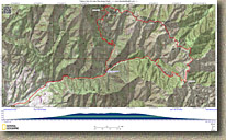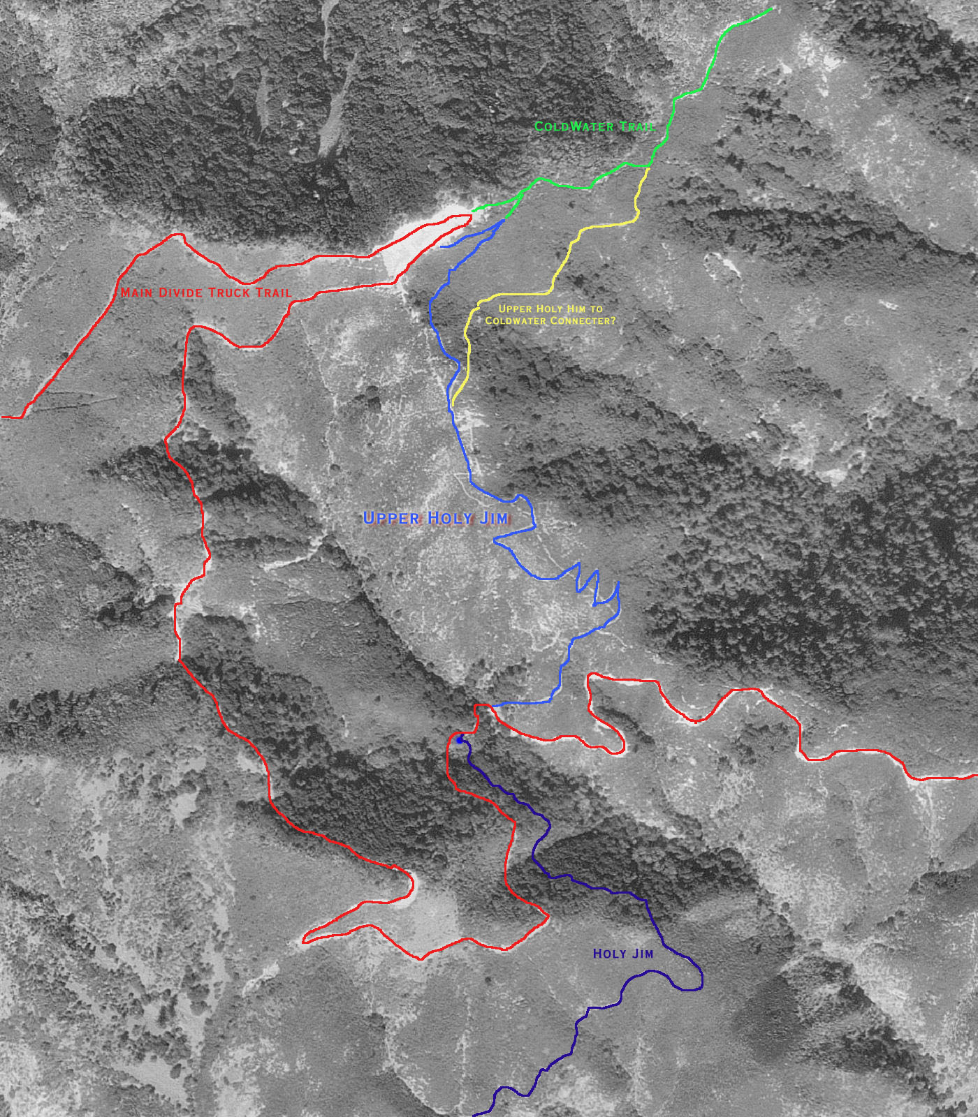
Holy Jim - Trabuco Canyon Loop
The Trabuco Canyon, West Horse Thief and the Holy Jim Trails all share a common trailhead which makes them easy to combine into some really nice riding. I already have a web page for both Holy Jim and Trabuco Canyon. This page describes the loop and shows some pictures of the Main Divide Truck Trail that connects to two up. Holy Jim Trail Trabuco CanyonDirections: (From San Diego) Take the I-5 north. After passing through San Juan Capistrano and just as you near the Mission Viejo area, take the Oso Parkway exit. Turn right and take Oso Parkway east for 2.5 miles. Turn left on Antonio Parkway and take it north for 5.6 miles. Turn right on Santa Margarita Parkway and 2/10ths of a mile later turn left on Plano Trabuco Road. After .6 miles the road will turn to the left and become Trabuco Canyon Road. After traveling .8 miles and you will see a dirt road on your right just before a small bridge. Turn right onto the dirt road and take it 5.5 miles to its end. Park there at the end and the trail starts from there. The dirt road can be pretty rough, so ride with someone who has a truck. Some people park right at the beginning of the dirt road and ride their bikes in to the trailhead. |
|
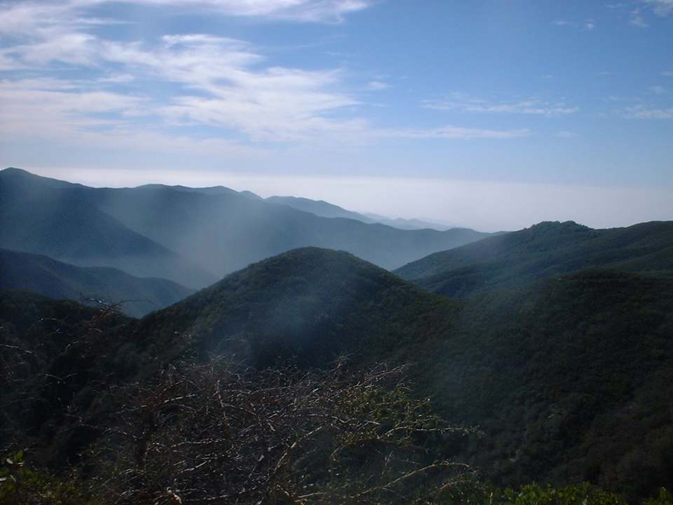
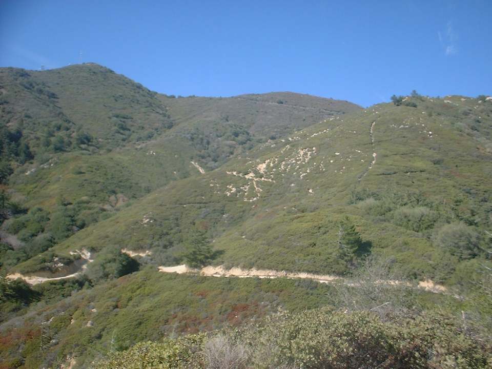
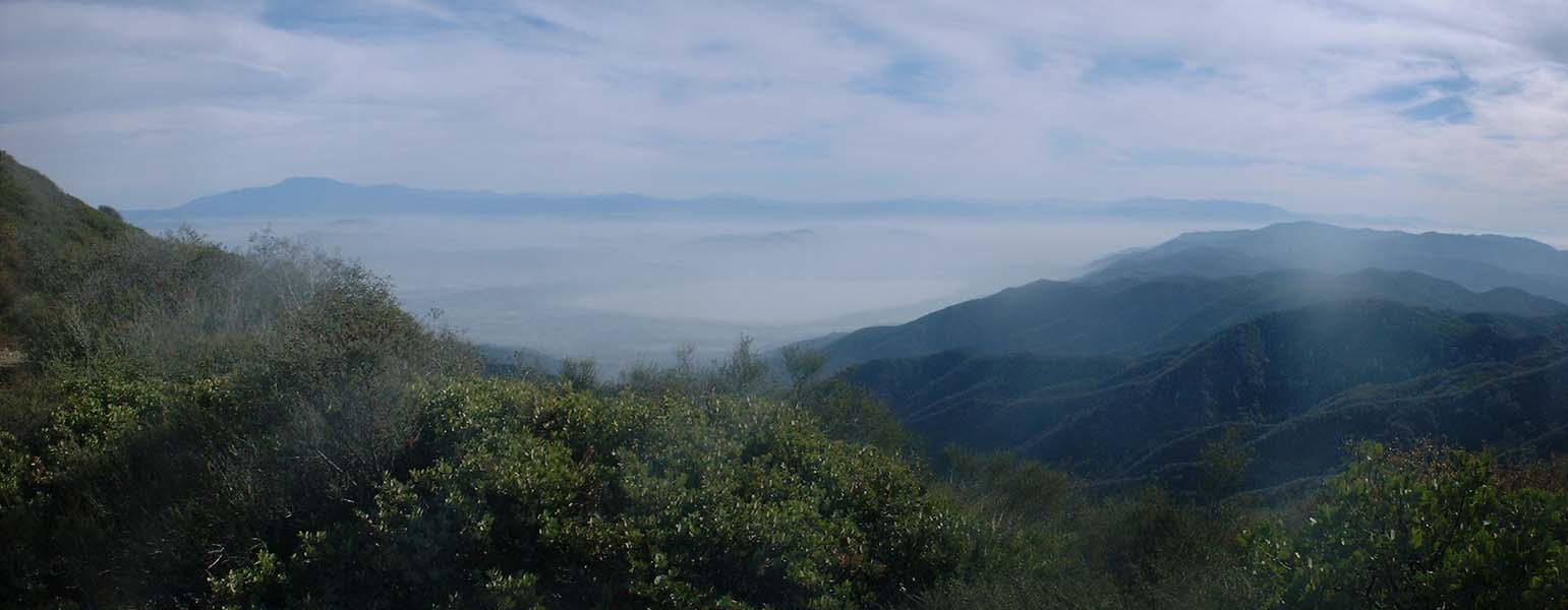
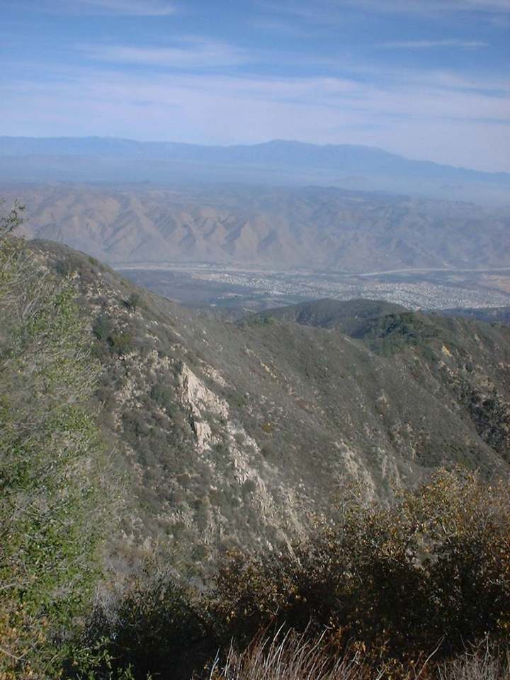
NOTE: This is also an excellent route done in reverse, going up Holy Jim and down Trabuco. The climb up Holy Jim is easier than going up Trabuco. I have done the route both ways and I would give a slight edge to the reverse of this described route. This route starts off with you heading up Trabuco Canyon which after 5.5 miles of taxing sometimes technical climbing you get up to the Main Divide Truck Trail. From here you will hang a left on Main Divide. You will also notice that there is another trail the goes straight up a hill to the right. This is the upper end of the Los Pinos Trail. That trail ends of up at the lower trailhead for the San Juan Trail. It is on my to do list of trails to check out. Anyway after hanging a left of Main Divide you get your first taste of downhill since you started up Trabuco and boy is it fun to have some speed on your wheels even if you are on a fire road. The downhill is short lived as Main Divide does a lot of roller coastering. At around 7.0 miles the views to the East really open up and scenery is absolutely incredible as you look down on Lake Elsinore to the east and the San Bernardino Mountains in the distance to the northeast. |
 |
 At around 7.37 miles you will pass by East Horsethief Trail that
heads down the mountain to the east. You do not want to gone this way on
this trip. You continue riding along the ridge tops as the and views on
either side continue to remain spectacular. At around the 8.0 mile mark
you will pass the upper trailhead of the West Horsethief Trail. If
you need to cut this route short, this is the place to do it. I have not
ridden this trail but meets up the Trabuco Trail that you came up on. At around 7.37 miles you will pass by East Horsethief Trail that
heads down the mountain to the east. You do not want to gone this way on
this trip. You continue riding along the ridge tops as the and views on
either side continue to remain spectacular. At around the 8.0 mile mark
you will pass the upper trailhead of the West Horsethief Trail. If
you need to cut this route short, this is the place to do it. I have not
ridden this trail but meets up the Trabuco Trail that you came up on. |
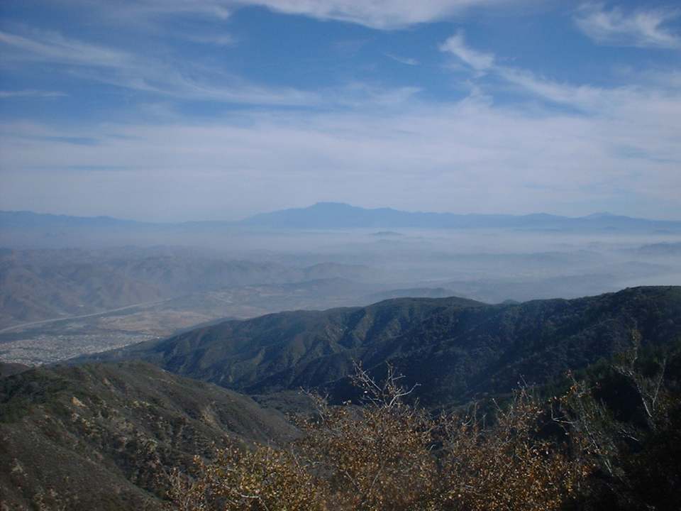
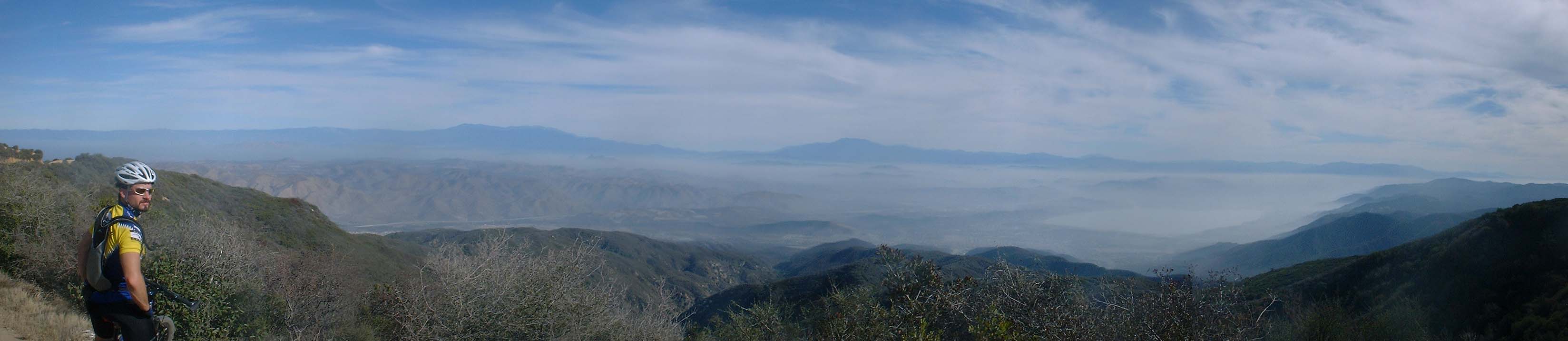 Here is another stunning view looking east from Main Divide. I believe this photo was taken around the 9 mile mark just before a steep section of climbing up to the highest point on this route as you head up Trabuco Peak. |
|
|
Additional Information |