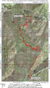
Holy Jim
| Sometimes known as The Holy S%&T! Trail for first time riders, this is a really fun Orange County ride that will test your bike handling skills. The Holy Jim trail is a very diverse trail that has you has crossing rocky creeks, riding among ferns and other greenery, and navigating loose rocks on skinny track. It will test your switchback skills and as well as your nerves on off-camber turns. With an a elevation change of 2,275 feet over 5 miles it will test your legs as well on the way up. |
|
GPS Files: TOPO!, GDB, GPX, KML
|
| Directions: Take the I5 North (from San Diego) and exit El Toro Road and head East. El Toro turns into Santiago Canyon Road. Make a right on Live Oak (Cooks Corner) and follow that 4.5 miles. After you cross Trabuco Creek turn left onto the dirt road and take it 5.5 miles to its end. Park there at the end and the trail starts from there. The dirt road can be pretty rough, so ride with someone who has a truck. Some people park right at the beginning of the dirt road and ride their bikes in to the trailhead. |
RIDE REPORT: The only time (so far) that I have ridden the Holy Jim Trail was part of an up Trabuco – Main Divide – down Holy Jim Loop. Check out the web page on that ride here. My description of this ride is from the downhill perspective, but I make some observations on what I think it would be like going up.
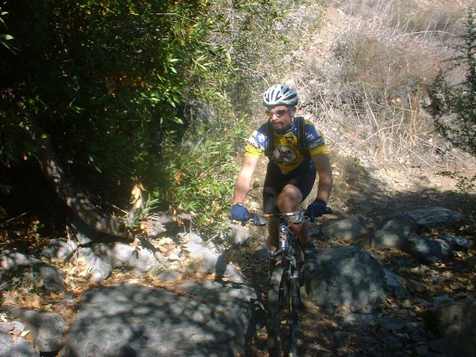
Starting out from Main Divide the trail starts with a technical drop in section that can be quite tricky. Going up I imagine it will be a hike-a-bike for most riders. After the technical drop in you a have to do a very short bit of climbing while under a canopy of hardwood trees. Shortly after the climbing section you are out from under the trees. |
|
|
This is a 9-mile ride if you go up and then come back down the way you came. However I think this trails is best combined with some of the other excellent trails in the area for some great loops and epic rides. From the top of Holy Jim you can hang a right over to West Horsethief and the Tracbuco Trail. Or you can a hang a left and go up to Santiago Peak and Harding Truck Trail, Maple Springs, Silverado Motorway, and Black Star Canyon. Basically there is as much fun/pain as you can take available to you from here. |
 TRAIL
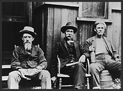
HISTORY: (From the Cleveland National Forest Website) If you expect that the Holy Jim Canyon is named for a pious, early preacher
in the Santa Ana Mountains, you would be very wrong! Jim Smith was a beekeeper
who settled in the north fork of Trabuco Canyon in the 1870s. It was said that:
"Jim Smith was a talker...no ordinary talker... a man given to blasphemous
eloquence. When he started cussing... he could peel paint off a stove
pipe." When government surveyors first mapped the canyon, they chose to
name it "Holy Jim" rather than "Cussin' Jim," since the word
"cussing" was considered neither polite nor appropriate for a
government publication.
TRAIL
HISTORY: (From the Cleveland National Forest Website) If you expect that the Holy Jim Canyon is named for a pious, early preacher
in the Santa Ana Mountains, you would be very wrong! Jim Smith was a beekeeper
who settled in the north fork of Trabuco Canyon in the 1870s. It was said that:
"Jim Smith was a talker...no ordinary talker... a man given to blasphemous
eloquence. When he started cussing... he could peel paint off a stove
pipe." When government surveyors first mapped the canyon, they chose to
name it "Holy Jim" rather than "Cussin' Jim," since the word
"cussing" was considered neither polite nor appropriate for a
government publication.
The Video
 |
This video was shot in November of 2002. 24MB |
Upper Holy Jim and Coldwater
 |
The Upper Holy Jim Trail is short but fun add-on to the Holy Jim trail.
If you are doing a one of the big loops that take you over Santiago Peak, such
the Harding to Holy Jim loop this
is a much better way to go down than using the Main Divide Truck Trail. Splitting off from the Upper Holy Jim trail is the Coldwater Trail. It is no longer maintained by Forest Service and there are some private properties at the bottom of the trail that causes access issues. |
To the best of my knowledge there are only a couple of single tracks going down the eastern slopes of the entire Santa Ana Mountain Range, Coldwater and East Horsethief. Both of these trails have private property access issues at the bottom. I believe that the population of the communities at the base of the eastern slopes of the Santa Ana Mountains deserve access to at least a couple recreational trails and public easements should be granted for the original (and historic) trails of Coldwater and East.
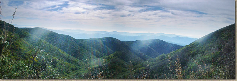
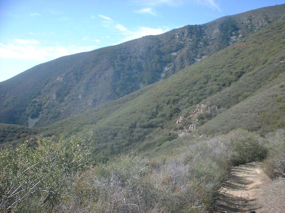
To get to the top of the Upper Holy Jim from the junction of Holy Jim and Main Divide, turn left and go uphill. The next 1.5 miles can be quite tough on climbing fatigued legs. This section is gravelly and combined with its average grade of 17 percent can be a grunch of work. As you come up to a really large opening at a left hand switchback that has been chewed up by the four-wheeled drive types. Just shy of the switchback is the singletrack heading off to the right. Do not jump down the trail yet. Continue to the apex and take in the great views from 4,874 feet.
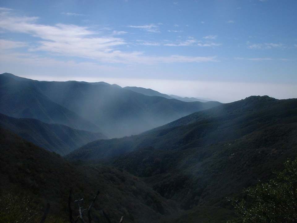
Some views from along the Upper Holy Jim trail. The picture on the right is the split for the Coldwater trail


 |
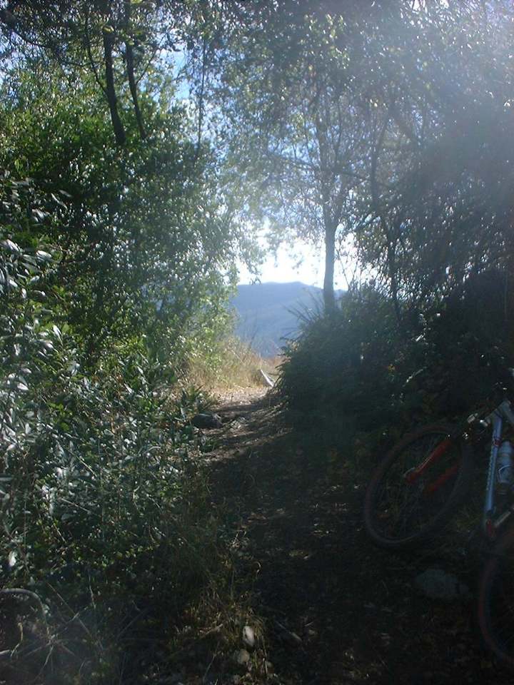
The bottom of the Upper Holy Jim brings you out about 300 yards further down Main Divide. You will need to hang a right to get to the Holy Jim Trail. These picures are of the orginal line that has been rerouted. |
 |