Wilder Ranch in Santa Cruz CA
Foreword: In June of 2002, my work took me to the San Francisco Bay Area. As you must have already figured out, I did some mountain biking. I had a Friday, Saturday, and Sunday to get in some riding. Downtown San Francisco was my "base camp" and I put on quite a few miles on the rent-a-wreck I had. Friday I rode Oat Hill Road; Saturday I rode Skyline Wilderness Park; and Sunday I rode Wilder Ranch.
Summary: My last ride of the trip was at Wilder Ranch in Santa Cruz CA on June 23rd, 2002. I found a lot of really good reviews of this place with everyone mentioning the views. From the reviews I was expecting a wonderfully pretty place of mostly fire roads with some really nice single track here and there in the beginner/intermediate category. I was not disappointed. This is a great place to go and just have fun. While there are a few technical spots (mostly uphill rooty climbs) your average intermediate rider will not be challenged much. There are a lot of trails just outside of Wilder Ranch that are more technical that can be connected up to make both a really pretty and technical ride (So I was told by someone at the end of my ride). Wilder Ranch is worth a visit just for views if nothing else.
Directions: From Santa Cruz take HWY 1 north out of Santa Cruz. About 2 miles out of town, you'll see the Wilder Ranch complex on the left.
 Here
is a map that I pulled in off of the internet. It was developed by
Mountain
Bikers of Santa Cruz.
Click it for a full-size
version (put together by Dave Luke).)
Check out MTB.live.com for additional information about this map and other Northern California MTB rides.
Ride Report: While there are hundreds of ways to ride the trails of Wilder Ranch, I rode a route that let me hit just about all of the single track and it was recommended by quite a few folks on the various trail review forums and sites.
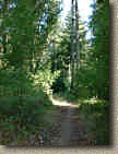
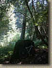
From the parking lot on the Ranch, I went under HWY 1 via the tunnel just east of the parking lot. I took the Engelman Loop, which is a fairly smooth fire road up to Long Meadow loop. The climb up through this section was gradual and it cut through a large meadow. I eventually met up with the Long Meadow trail. This trail is another smooth fire road that climbs gradually. Eventually Long Meadow connects up to the Chinquapin trail. The ride along Chinquapin allows from some speeding riding on another smooth fire road. I eventually hooked up with the west side of Eucalyptus Loop. I followed the Euclayptus (another fire road section) to the Enchanted Loop. The Enchanted Loop was a real treat offering a single track ride that weaves among towering redwoods and a forest floor full of green ferns. The climbing intensified coming out of the Enchanted Loop with a technical climb that was steep with lots of roots to navigate. At the top of the climb you quickly roll out from under forest canopy and back out into a meadow. There is a Y in the single track shortly after you exit the forest. Bear to the left (My route brought me back by here). Shortly after bearing left I meet up with the Sea Ridge trail and hung a left on this fire road.
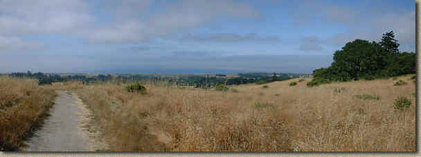
A panoramic view from Eucalyptus Loop
I followed Sea Ridge back to the junction of the Eucalyptus and Enchanted Loop. I then went east of the southern part of the Eucalyptus Loop which is single track in this section. This single take across a meadow and eventually back into a stand of trees where you cross a creek. After crossing the creek you roll back into another meadow. The trail turns north and after some gradual climbing you come to the junction of the Old Cabin Trail on your right. The Old Cabin trail is wonderful section of single track that offers some more forest and fern riding. The climb out of Old Cabin can get your lungs working. Here I turn around and went back on the Old Cabin Trail ( I did this because the Wagon wheel trail was closed (supposed to be a cool single track)) and then we back west on Eucalyptus. Just after crossing on the creek on Eucalyptus and coming out of the woods I hung a left on the Twin Oaks (this portion no shown on the map) and followed this sweet single track all the way down to the Wilder Ridge Loop.
A panoramic view near the top of Engelsman Loop
I hung a left here on this fire road and headed west along Wilder Ridge Loop until I hooked up the Sea Ridge trail again, this time making my way back to the south end of the Enchanted Loop. I followed the Enchanted Loop for about 50 yards and then hung a left a the Y described above to get on the Rim Trail. The Rim trail is a fast narrow single track along the east of a meadow that constantly has you looking at the Pacific in the distance. Eventually the Rim Trail runs into the Baldwin trail. From there I bombed down Baldwin which had a few mildly rocky sections. The trail drops you into small canyon/ravine that is fully of wild flowers. This section was very picturesque but at the speed I was going I did not have much time to look. At the bottom of the hill the trail takes you past a farm house and then through a tunnel that takes you under HWY 1 again and then right down to the ocean. This beach is this area is absolutely amazing with sweeping beach coves framed by vertical cliffs that just scream for you to just chill near. After taking in the view of the beaches, I continued along the cliff side trail for a while until I decided that the trail was too sandy. I then followed along the edge of an agriculture field to cut back over to the HWY 1 and rode back to the parking lot.
Video
2007 Update
I went back to Wilder Ranch in 2007 as part of a Summer Tour through NorCal so make sure to check out that review.


