Broken Mesa Rim
Located just outside of St. George, Utah the Broken Mesa Rim and Ice House Trails are a couple of great "untamed" single tracks that offer both great views and exceptional mixes of technical sections as well as long runs of narrow downhill goodness that should have just about anyone smiling. "Single track connoisseurs" with solid technical skills will really appreciate this place. These trails have not seen much use in the last year since I first rode them. It is a shame. If you are a fan of the Prime Cut trail in Fruita's Bookcliffs trail system then you will love the upper portion of the Ice house trail. With some regular use to pack this trail down it would be like Prime Cut but twice as long.
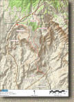
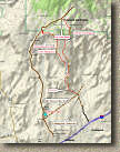
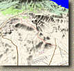
Maps: Here is a collection of printouts from the mapping software I was using for this trip. It is not my usual software and I am not particularly fond of it. The only really cool feature it has that I like over National Geograhic's TOPO! software is the 3D map feature. I have included three maps of this area.
Directions: From the St. George Blvd exit of I-15, turn towards the city (west), then immediately turn right onto N 1000 E East. Zero your odometer here. Take the first right on to Highland Drive. There is a Wendys here that I'll talk about later. Travel .1 miles and take the first left onto Industrial Road. 0.6 miles later turn left onto Red Rock Road. Now mapquest as well as my topo software shows that you should turn left onto Old Dump Road, but we never saw such a turnoff and just continued on Red Rock Road where it somehow becomes the Old Dump Road you see online. The road will turn to gravel within a couple of miles and shortly thereafter you will pass a Water Tank on your right. This is one on your parking options for a loop or shuttle as this is where the Powerline fireroad trail comes out on the road. About 2 miles past the water tank there is a fork in the road. Take the left fork and continue uphill. 1.92 miles after the fork you will see a much steeper section of road cutting up the side of a hill ahead. Off to the right is a gravel parking lot off which is a good spot for low clearance vehicles to stop. If you decide to continue driving up the road you will continue on another 1.5 miles were you will turnoff to the right into another gravel parking area. There is also a sign that says "Red Cliffs Mesa Rim Trail". You are just about 9 miles from the Interstate at this point.
Shuttle options:
| If at the bottom of the Ice House Trail you hang a left and go maybe 50 yards and hang a right on a dirt road after a couple of telephone poles the road will work its way downhill into some new home developments where you can just hookup with the main roads and go mostly downhill to the Washington Exit (#10) north of Interstate 15. If you leave a vehicle here you will be good to go. You could also leave a vehicle back at that Wendys you passed by on your way to the trailhead. At the end of the ride when you get to the come down by the Washington Exit, hang a right onto Highland drive and ride the pavement a couple of miles back to the Wendys. | |
| Leave a car by the water tank on you way out Red Rock Rd. (Its on the map). When you get to the bottom on the Ice House trail hang a right on the Powerline trail and take it back to the water tower. Note: It can get a little sandy. | |
| If all you want to do is the is the Ice House trail you can continue up the dirt road 1.76 miles past the upper parking area for the Broken Mesa Rim Trail to reach the upper end of the Ice House Trail. (I have not done this route) |
So why I'm I telling people how to shuttle this ride? Most people that have ridden with me know I'm not a fan of shuttle rides and I go out of my way not to tell people how to shuttle a ride. So here is why I making an exception. These trails need to be ridden. They are getting so little use that they are starting to get loose and faint enough in some spots that mother nature will most likely reclaim the upper portion of the Ice House trail by this time next year. These are great trails and they need to be ridden and maintained. So if it takes telling people how to cut out the climbing to get these trails ridden then it is worth it.
Ride Notes: Broken Mesa
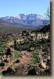 From the upper parking area, the Broken Mesa Rim trail climbs immediately with
some switchbackes and enough lava rocks and small ledges to take a extra bit of
energy out of your legs and lungs. You only gain about 350 feet in the
first mile but it feels like more than that. About half-way up this
climb onto the rim you will cross over some kind of pipe and doubletrack, just
pick up the trail on the other side. This was my second time on this ride
and since last year the Mesa was partially burned. The recovery seems to
be going well with plenty green grass across the Mesa.
 Up
near the top of the climb things get quite a bit more technical with a series
ledges and sneaking between lava rocks moves known as "Kevin's Gate".
Kevin was pretty modest about his design work that day but he really is a trail
building genius.

 The
climbing levels out for the next 6/10ths of a mile before a wide open downhill
starts. Last year this section was much greener where often the only way
to discern the trail was to look for the short grass in the middle of the long
grass. This year the trail was not quite as green but it was never the less
quite skinny.
 After
this the trail turns downhill and sweeps back and forth down along the top of
the wide open mesa. There are some lava rocks to go over as part of
the trail features that will keep your from dazing off with the views around
you. This downhill action will continue until you hit mile four.
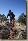
The picture to the left was taken by Jerry Daniels of Kevin Foote coming down the Mesa
through part of the burn area.

 Broken
Mesa joins the Ice House trail at mile four. I refer to everything
to the right (south) of the sign as the Lower Ice House trail and everything to
the left (north) of the sign the Upper Ice House trail. The most popular
route is to turn right here and continue downhill on the Ice House Trail.
We went this way last year, but this year we checked out the upper portion as an
out-and-back and it was well worth it and I highly recommend it.
Upper Ice House Out-and-Back
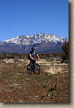
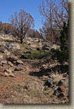 Turning
left at the sign you will start some extremely mild climbing northward on in the
Mesa. The trail is extremely smooth but not very packed in due to the
little use it has seen. It is often identified only by a shallow
indentations in the ground and short versus taller grasses. The
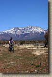
views of the Dixie National Forest and the snow capped Pine Valley Mountain
Wilderness beyond were impressive. As you near the top of the 3.6 mile upper
section you will transition from wide open mesa into sparse trees. You
will also get to deal with some large rocks in the trail and a dry stream
crossing. If you keep a sharp eye out, you will notice a few mine cart
grooves cut into the rocks.
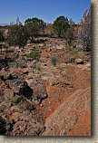
 The
top end of Ice House comes out on the same dirt road that you took to get to the
Broken Mesa trail. From here you turn around and enjoy this trail in the
the mostly downhill direction. The rocky stuff near the top is a
bunch of fun when carrying some speed and after crossing the creek and climbing
back up to the wide open mesa area the blaze fest really starts.
This section of trail is extremely narrow with incredible sweeping flow and
great vistas. While we were cruising at really good clip, I could only
imagine our fast we could have gone if the trail was a bit more packed down.
The 7.2 miles of additional trail you get with this out-and-back should not be
missed.
The
top end of Ice House comes out on the same dirt road that you took to get to the
Broken Mesa trail. From here you turn around and enjoy this trail in the
the mostly downhill direction. The rocky stuff near the top is a
bunch of fun when carrying some speed and after crossing the creek and climbing
back up to the wide open mesa area the blaze fest really starts.
This section of trail is extremely narrow with incredible sweeping flow and
great vistas. While we were cruising at really good clip, I could only
imagine our fast we could have gone if the trail was a bit more packed down.
The 7.2 miles of additional trail you get with this out-and-back should not be
missed.
Lower Ice House
 The
downhill return to the junction of the Broken Mesa Rim trail happened all
to quickly. We could have blown right on by the junction but we stopped
just so we could giggle like little school boys who had just stolen a nudy
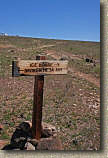
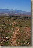
magazine from their older brother for the first time. The Lower Ice House
trail is 2.4 miles long with most of that still working its way down along the
top of the mesa. When we got rolling again the blaze fest was back
in full swing and it even picked up a notch or two as some sections were a little
steeper than others, but still mostly mild. The further down the mesa you go, the
rockier the trail becomes and in a few spots a quote from Clint Eastwood
starting rolling through my head, "A man has to know his limitations". It
was the classic sprightly Angel on one shoulder, and the masculine devil on the
other kind of thing.
" ![]() Don't
touch those brakes you got this."
Don't
touch those brakes you got this."
"![]() Your going too fast!"
Your going too fast!"
"![]() You've ridden faster than
this before."
You've ridden faster than
this before."
"![]() You are a father, if you
crash now..."
You are a father, if you
crash now..."
"![]() SHUT UP BI!&H, HE's GOT
THIS!".
SHUT UP BI!&H, HE's GOT
THIS!".
Finally Clint stepped in, shot them both and I got back to confidently riding.
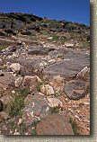 At
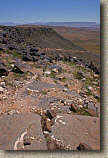
little under two miles from the junction of the Broken Mesa Trail, Ice House has
makes a sharp left hand turn and starts a technical rocky descent off of the
Mesa called "The Cut." The left-hander at the top has a couple of ledges that
combined with some well placed rocks could grab a front wheel if you your weight
just the least bit too far forward. Once onto The Cut it is loose and rocky
and requires you to keep your speed well under control because slowing down can
be a real issue in some spots on the way down. The Cut is a little
over a half a mile long but packs quite a punch. Burning quads and cramped
hands are common at the bottom.
From here, based on where you parked, you will either go right towards the Water Tank or left and make your way down to the Washington exit area. If you did the Upper Ice House out and back your mileage should be about 14.2 miles since you first got on the Broken Mesa Rim Trail. According to how you finish up to get back to your vehicle you could end up with quite a few more miles. No matter which way you go from here you should end up thinking the ride was well worth it.
This ride was Day Three of my Nevada and Utah 2006 Roadtrip.


