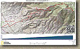
Nate Harrison Grade Road
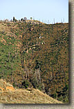
Nate Harrison Grade is on the southwest side of Palomar Mountain in the north end of San Diego County. This is one continuous climb that will certainly test your climbing strength. It has an average grade of 8% over 11.1 miles with some parts being much steeper. With almost 4700 feet of climbing this is a great workout ride with the reward of stunning views and a real sense of accomplishment at the top. A portion of the south slope of Palomar Mountain that Nate Harrison Grade passes through burned in the 2007 wildfires. While the impact is still noticable, the flora has been recovering nicely.
Directions: These directions have you parking at the Pauma Valley School about 3/4 mile from the start of Nate Harrison Grade road. This is the closest place to park without setting precariously on the side or the road.
| From the San Diego Area: Take I-15 to the 78 East. Follow the 78
east through Escondido (a bunch of turns) for about 2.8 miles. At Valley
Center Road (there's a Circle-K at the corner) turn left on Valley Center
Road and go 9.4 miles to Cole Grade Road. Make a left onto Cole Grade
Road and go 7.5 miles and pull into the Pauma Valley School on the
left. If you get to the 76 you've missed it, go back 1/2 mile. | |
| From places north of Escondido: From I-15 take highway 76 east for 15 miles. Hang a right onto Cole Grade Road and park in the Pauma Valley school parking lot 1/2 mile down the road on the right. |
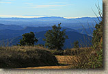
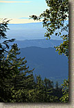
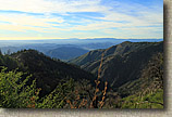
 Downtown San Diego and the Coronado Islands seen from Boucher Lookout |
Hazards: The road is open to motor vehicles so beware, particularily if on your descent. |
| The Ride: |
|
  The first part of the climb has you passing through colorful orange groves. As you
continue upward you get to watch those groves get smaller and smaller as you climb
through rocky sage type terrain. The views just keep getter better as chug
along.
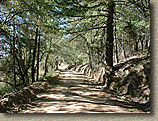
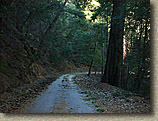
Around the 4,000 feet elevation mark near the top the flora transitions into
forest filled with large pine and cedar trees that keeps you in a constant
shadow. It was hard to believe that just a mile back down the trail I was
in open mountainside.
The first part of the climb has you passing through colorful orange groves. As you
continue upward you get to watch those groves get smaller and smaller as you climb
through rocky sage type terrain. The views just keep getter better as chug
along.
Around the 4,000 feet elevation mark near the top the flora transitions into
forest filled with large pine and cedar trees that keeps you in a constant
shadow. It was hard to believe that just a mile back down the trail I was
in open mountainside. |
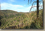
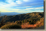
 San Jacinto Mountain in the distance can be seen as you near the top of the Palomar Ridgeline |
  At around 9 miles (from the school) the trail turns into
narrow payment that is broken in many places. At around 10.5 miles you
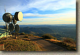
come to a five point intersection. Take the hairpin turn up to your right up to Boucher Lookout
(there is a sign). At 11.1 miles you reach the lookout at 5438
feet. Take in views of the nearly 4700 feet you climbed to get
here. At around 9 miles (from the school) the trail turns into
narrow payment that is broken in many places. At around 10.5 miles you
come to a five point intersection. Take the hairpin turn up to your right up to Boucher Lookout
(there is a sign). At 11.1 miles you reach the lookout at 5438
feet. Take in views of the nearly 4700 feet you climbed to get
here. |
|
|
|
|
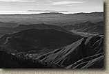
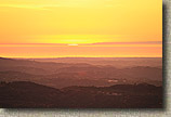 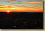 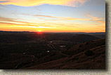  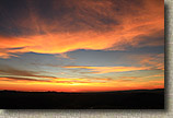 A killer sunset seen from Nate Harrison Grade Road. |
| Note: For a yummy after ride meal continue west on the 76 for 1/4 mile past Cole Grade Road to Jilberto's Taco Shop. |