Elfin Forest
There are two things you will not find at Elfin Forest, elves or a forest. The place gets in name from the nearby rural community of (You guessed it) Elfin Forest. While not offering a lot of miles, I would say they are quality miles that will certainly get your lungs working and require you to use some technical skills. This is a good place to get in a good workout when you do not have the time to knock out a bunch of miles, or travel very far. Additionally, the sweeping views and cool air coming in off the Pacific makes this a very pleasant place to ride.
Here
is a topographic map of Elfin Forest. With all of the thin brown lines
closely spaced together (can you say leg burn!) you may find the trail
map from the park's
website a little less cluttered.
Here
is the profile of the main climb which is called "The Way Up" trail.
Directions:
|
From areas north (Coastal): From the I-5, take HWY 78 East from Oceanside. From either direction take the Nordahl exit off of the 78 (Nordahl exit is in Escondido). Turn south at the light. After .3 miles and turn right onto Country Club Drive. Take Country Club Drive for 2.5 miles to Harmony Grove Road. Turn right and follow Harmony Grove Rd for 1.6 miles. Look for the entrance on the left. | |
From areas north (Inland): From the I-15, take HWY 78 West when coming into Escondido. After about 1 mile or so take the Nordahl exit. Turn left at the light onto Nordahl Road. After .3 miles and turn right onto Country Club Drive. Take Country Club Drive for 2.5 miles to Harmony Grove Road. Turn right and follow Harmony Grove Rd for 1.6 miles. Look for the entrance on the left. | |
|
From areas south: Exit the I 15 at Valley Pkwy in Escondido, go south 1 block to Auto Parkway and turn right. Turn left on Howard Ave. (about 1/2 mile). Turn right on Harmony Grove Rd. Stay on Harmony Grove Rd. for about 3 miles to Elfin Forest on your left. |
Ride Notes:
This trail was burned in the 2007 Wildfires affecting abut 30 acres east of the Escondido overlook to the east.
This place has received some very bad press in the MTB forums over the last
couple of years due to the ongoing Olivenhain Water Storage Project (aka
reservoir) which shutdown over half the trails in the area. There
was even a period of time when the only trail open was "The Way Up"
trail which all by itself would lend this place to bad reviews. I
wish I would have given this place a shot a lot sooner as it is well worth a
visit. While this place doe s not over much mileage, it is good
training mileage.
From the parking lot there is only one way to go and it is called "The Way
Up". It is a 1.4 mile climb can gains 700 feet. The climb
has some nice rocky sections here and there which will require both finesse and
power to clean. As an additional technical kicker the
"peak" move is often at the end of a section that required both
elevated and sustained power output. You will also find quite a few
switchbacks on this climb. They vary in difficulty from wide
sweepers to tight with rock ledges. What I have found to be quite
challenging is loose rocky section near the top of the climb.
Normally this section would not be hard if you were fresh but the previous 1.2
miles of climbing makes this tough to clear unless you saved a little
something.
Note:
In the winter of 2005 a landslide and other significant damage, caused by near
record rainfall, forced the closure of the park for several months. During
that time extensive repairs were done to The Way Up trail that will allow for
the better drainage and it's long term sustainability. In the short term,
all of the recent work has left the trail looking rather "clean" and less rocky
and rutty. In has in no way become and easy trail, and some of the
armoring that has been done to trail as well as a season or two or rain and
traffic will not only bring back out some the old character of this trail, but
make it even better than before.

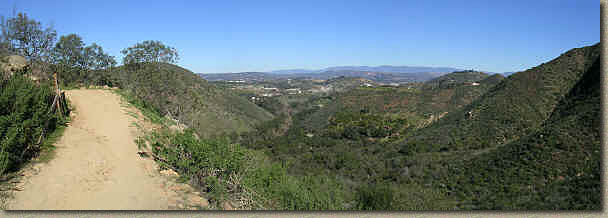
A pan shot from "The Way Up" Trail
Once you finish off "The Way Up" the trail
flattens out where you come to an intersection of several trails. All of
the trails ultimately end up some where near the flat spot so this is a good
visual reference to make. The route I prefer is to take is take the first
turnoff for the Enquine Incline Loop Trail. This is the main other
trail besides "The Way Trail" and this way has you doing the loop in a
counter clockwise direction. This direction offers some fun fast downhill
fun with a few technical section consisting of some rock steps and rocky loose
turns. You will ultimately end up in a low spot where you will get
to do some climbing up to the parks high point. This climb has some
technical obstacles that will require some good balance in places to get onto on
over some rocks.
After
about two miles along the Enquine Incline Loop Trail you will come to a high
spot and the junction on the Tyke's Hike trail off to your right. Take a
right here onto Tyke's Hike. There is a scenic overlook here where you can
take in break and take in some great views. On a clear day you can see the
San Jacinto and Cuyamaca Mountains as well as downtown San Diego, Point Loma, La
Jolla, and Coronado Islands off the coast of Mexico.
|
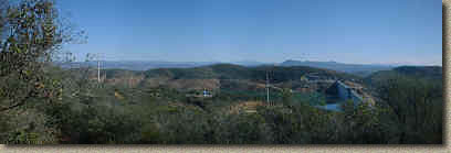
Some the incredible views from the top of Tykes Hike on a clear day |
|
|
|
|
From
here Tyke's Hike continues to the south where it offers up some views of the
reservoir, but keep your eyes on the trail as you will have some large rocks as
well as loose corners to contend with. Tyke's Hike is 1.25 miles long but
there are a couple of occasions were it dumps out onto a fire road and follows
it for a bit. On one such section of you will see an alternate trail for
the Enquine Loop trail off to the right. This 1/4 mile trail can be a
little bit more of a grunt to get back up to the scenic overlook than the main
trail. Take note of this marker as you will come back to this
spot.

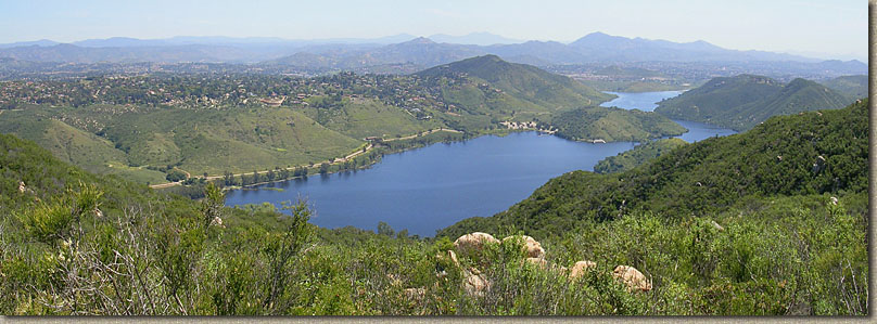
View of the reservoir from Tyke's Hike trail in December of 2003 (Notice where the high water
mark will eventually be)

Here is a view of the reservoir on April 11th,2005 - Full.
Anyway continue along the fireroad for maybe 100 yards and pick
up Tyke's Hike again off to the right. Follow this around
until it brings you back out near the main intersection area where you came it
at. From here you have the option of heading off to explore some of
the other minor trails in the park. I recommend that you head back to the
Alternate Enquine Incline Loop trail you took note of earlier. Take the
alternate trail back up to the scenic overlook by the Tyke's Hike
trail. From here take the Enquine Incline Loop trail in the opposite
direction that you did earlier. This direction (clockwise) offers a
longer more technical downhill before you have to climb back out.
Once back up to the main intersection again. Hang a left and take
"They Way Up" trail back down.
The descent down "The Way Up" can be a bunch of fun, but be on guard for hikers as this is a popular place on the weekends. Your total mileage should be around 10 miles.
Update
A new trail was added January 1st of 2005, the Lake Hodges
Overlook trail. The trail is a 1.8 mile long out and back that starts off
from the Escondido Overlook along a very wide fire/access road down the the
eastern end of the reservoir. Soon you will pick up the trail proper off to
your right. It is currently 6-8 feet wide in most spots in order to meet
county regulations on multiuse trail. The trail does have a few technical
items here and there and there are some pretty steep pitches coming out of tight
switchbacks as you make your way up to the south ridge. This is a good
addition to the trail network. Additionally there is a loop trail
under construction at the end of this overlook trail that will add an additional
mile of trail to the south ridge.

View of the reservoir from the South side along the new trail


